
Two aircraft, one console
Independent link stacks, telemetry and missions per team. Switch with one click.
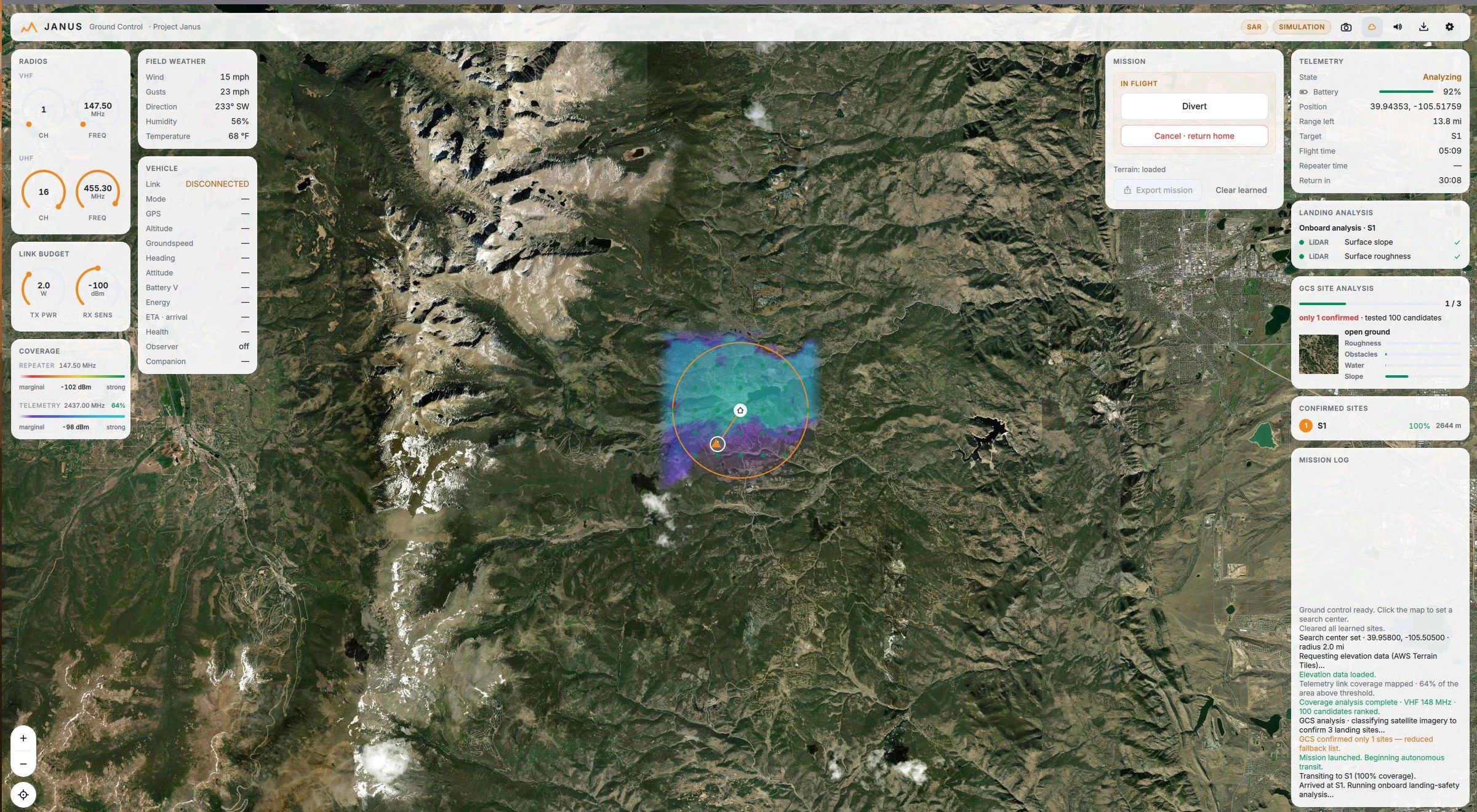
Project Janus plans the search, flies the mission, and proves what it found, even with no bars.
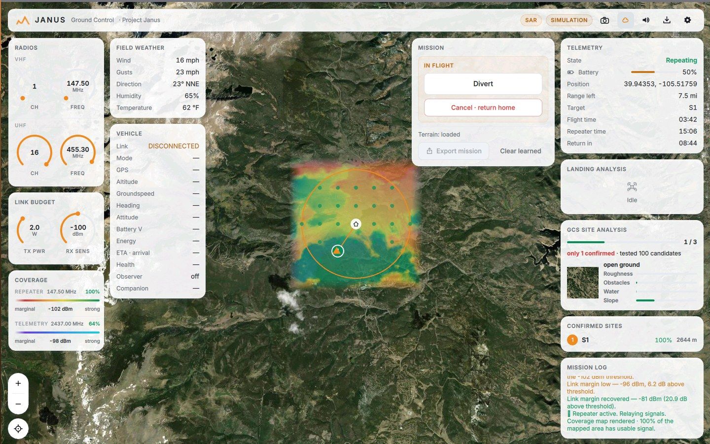
One screen holds the whole operation: terrain, radios, aircraft, verdicts, and the log that backs them up. No scrolling, no second laptop, no guesswork.
Drop a circle or trace a polygon, and Janus does the rest. Watch one simulated sortie run from the first click to the battery swap: terrain pulled, a hundred sites scored, the mission flown, the site confirmed, and the aircraft brought home.
A landing-safety CNN classifies satellite imagery for every candidate site at plan time: forest, water, structures, open ground. The aircraft only ever launches toward a vetted list.
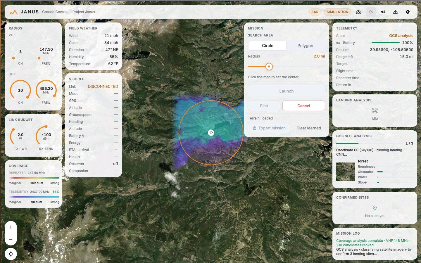
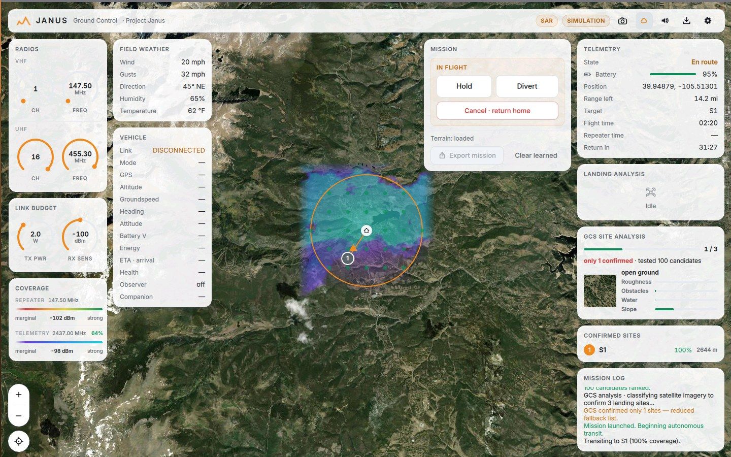
Autonomous transit at terrain-aware altitudes, with an energy model honest enough to bet a return leg on. Hold, Divert, and Return stay one click away the whole time.
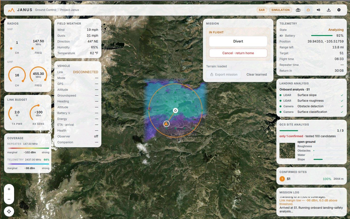
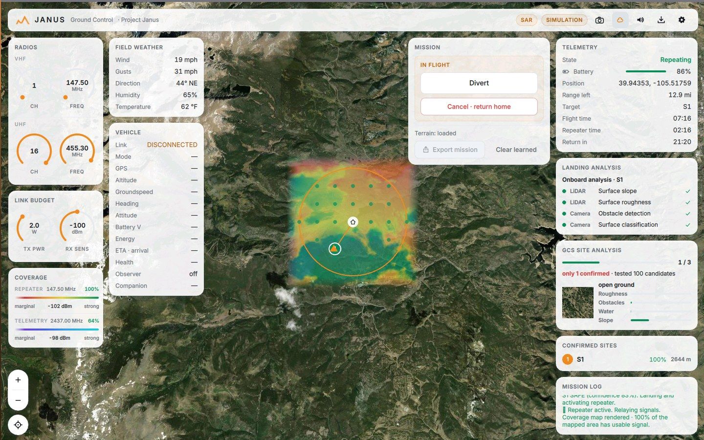
On arrival the aircraft grades the site itself, checking LiDAR slope and roughness plus camera obstacle detection and surface classification. You get the evidence, not just the answer.
Deployed as a radio repeater, the aircraft renders its real VHF footprint over the map, so ground teams see exactly where their handhelds will reach.
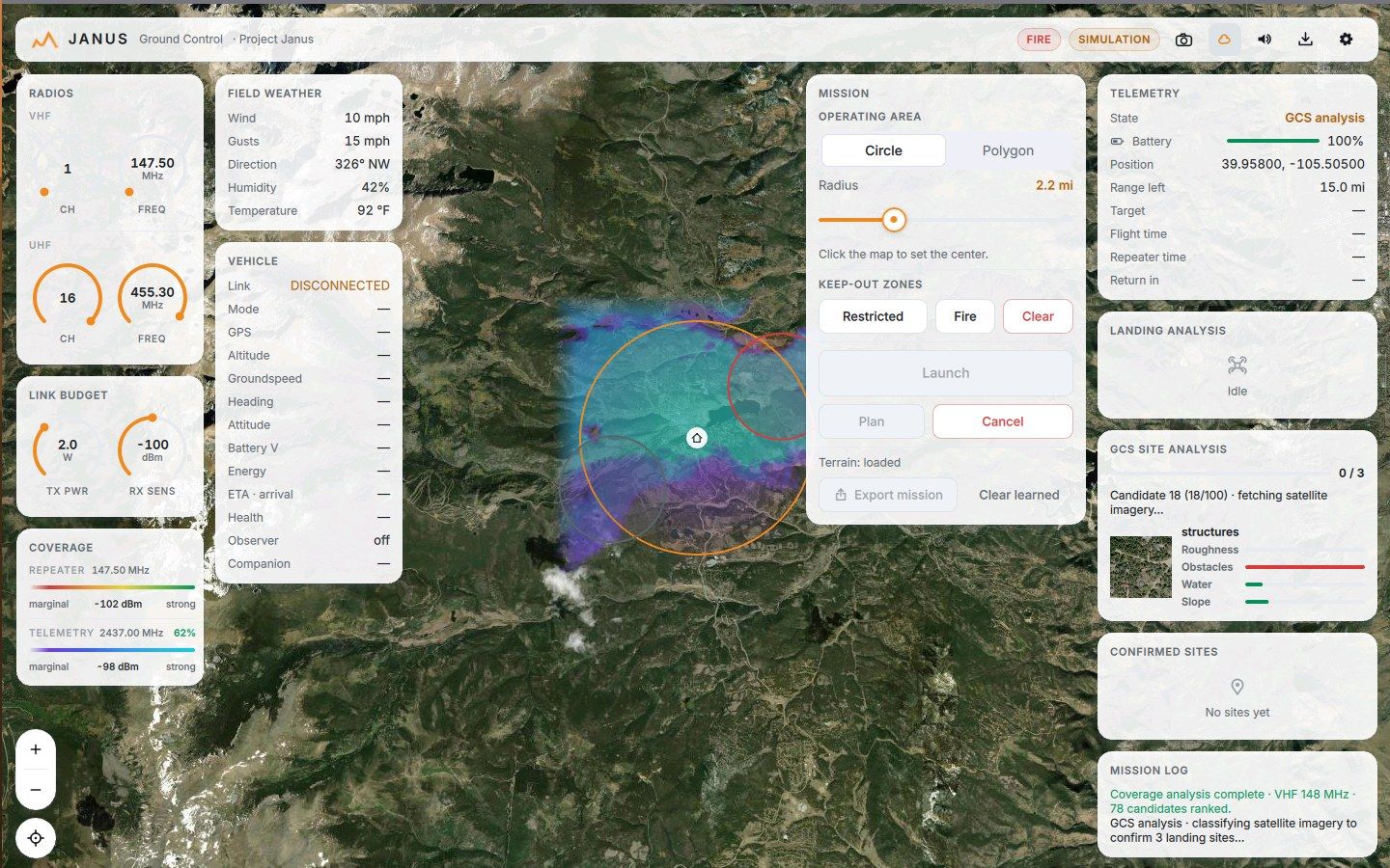
Fire and restricted zones drawn on the map become exclusion geofences uploaded to the flight controller itself, so the aircraft’s own failsafes respect them, not just the software.
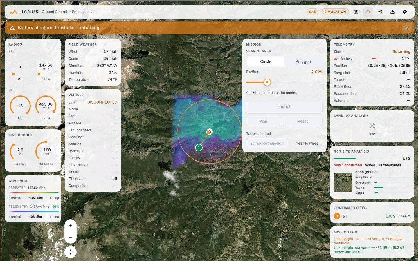
Battery at the return threshold, a link going soft, an un-commanded mode change: the banner goes up, the tone sounds, and the aircraft is already doing the safe thing.
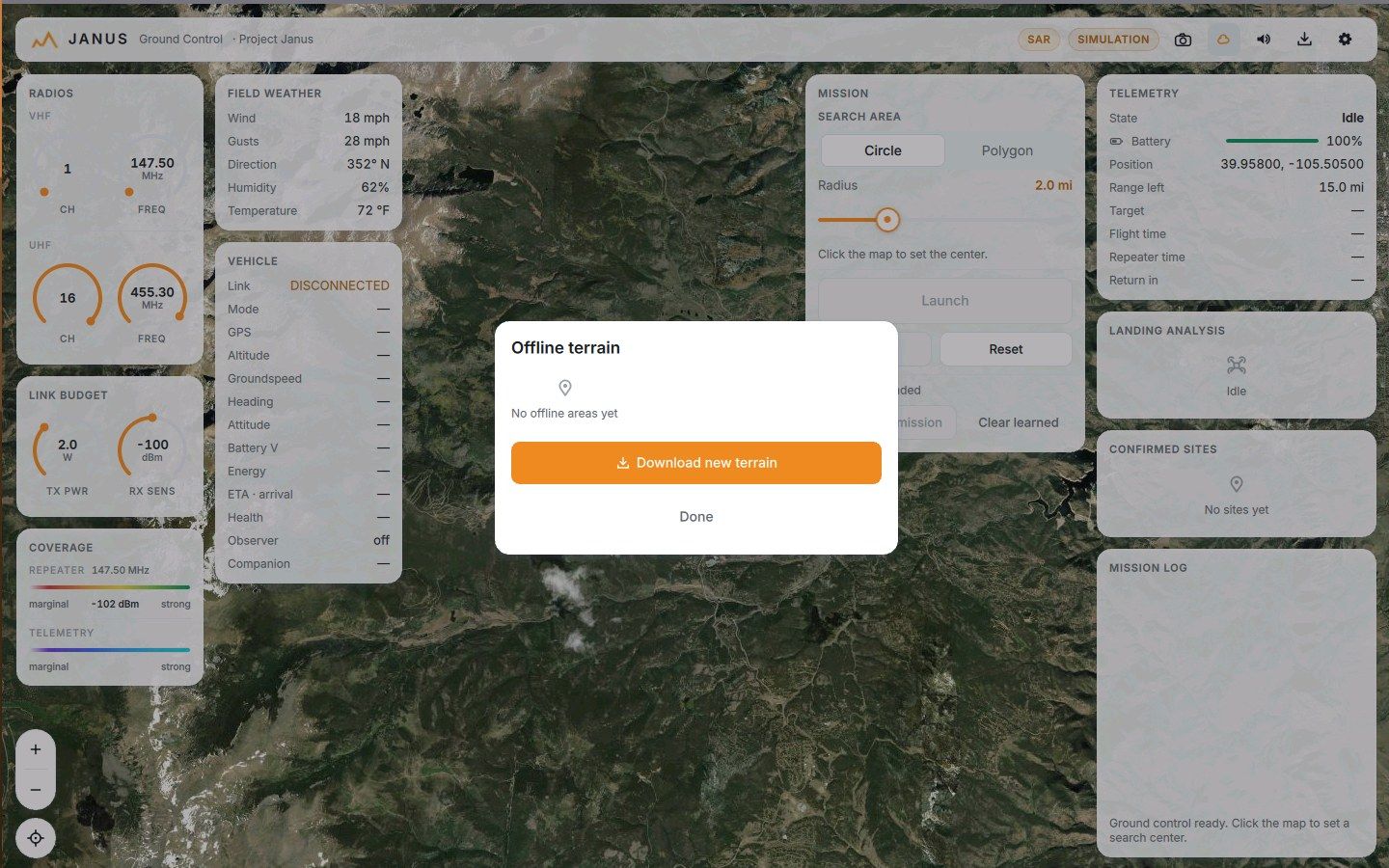
Pull terrain and imagery for any area ahead of time and manage it like the asset it is. In the field, Janus never assumes a connection.
Timestamped mission log, confirmed sites with scores, telemetry logs and video: everything an incident commander needs to stand behind the search afterwards.
Independent link stacks, telemetry and missions per team. Switch with one click.

The same console flies a simulation, a software-in-the-loop autopilot, or the real aircraft.

Radios, link budget and propagation coverage live on the dash, tuned to your actual hardware.
Failsafe parameters, EKF health, vibration and wind graded into one verdict before launch.
Forward live telemetry read-only to incident command. They watch in their own tools.
Inbound telemetry logs and HEVC video record automatically with every real flight.
Wind, gusts and humidity beside the launch button, where the decision gets made.
The whole mission, from sites and log to link quality and chips, lands in a folder you can hand over.

Full search planning, autonomous site work and repeater coverage for ground teams.

Operating areas with hard keep-outs: fire and restricted zones pushed to the aircraft as geofences.

A clean observer map when the mission is being flown by hand, with nothing between you and the terrain.
Anything that speaks MAVLink. Janus flies ArduPilot aircraft in GUIDED mode, including takeoff sequencing, terrain-aware legs, failsafe handling and RC-override etiquette.
No. Map tiles, satellite imagery and elevation data cache to local storage, and the offline terrain manager pre-pulls whole areas. The radios are yours; the console assumes nothing.
Two ways at once: a conservative linear battery model, and a measured one built from live power draw, cruise cost per kilometre, and wind-adjusted return pricing. The stricter of the two wins, and tailwinds are never credited.
Every leg flies level at the maximum terrain under its path plus a safety clearance, computed from elevation data with conservative sampling. Legs that can’t clear terrain or the ceiling are refused at plan time.
A propagation model renders telemetry coverage from home over the whole mission area. Sites without solid margin are excluded from planning, and legs below threshold are refused, with an explicit operator override if you know better.
Yes. The full mission loop runs in simulation, on synthetic terrain, with the same UI and the same decisions. Everything on this page was captured from a simulated flight.
The console runs happily on a Raspberry Pi 5. The aircraft carries an ArduPilot flight controller and a Jetson companion for onboard perception; a Microhard IP mesh carries telemetry, video and the side channel.